Gallery of new files
From EGM Heritage
This special page shows the last uploaded files.
-

-
EIC- ENGINEERING HISTORY PAPER34 An Engineering Career in the Hydro-Electric Industry - Len Bateman Memoirs.pdf Gcook
17:05, 7 April 2026
0 × 0; 8.21 MB
-
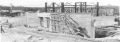
 1937 Kanuchuan Rapids aerial The Precambrian July 1937, p. 22 cropped.jpg Gcook
09:31, 30 March 2026
984 × 804; 449 KB
-
-

-

-
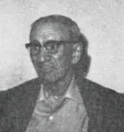 1929 1930 Charles Hartley Attwood 1963 interview in the Manitoba Professional Engineer.png Gcook
08:38, 26 March 2026
376 × 400; 159 KB
-
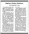 Jacob Hoogstraten Obituary December 1983 Manitoba Professional Engineer clip .jpg Gcook
14:29, 25 March 2026
537 × 624; 132 KB
-

-

-
 Winnipeg International Airport Comptuer Rendering of Proposed Airport, Photo Credit Stantec.JPG Gcook
14:08, 17 March 2026
2,080 × 1,333; 384 KB
-
 Royal-Aviation-Museum-of-Western-Canada Drone Winnipeg July-2022 Credit-Travel-Manitoba-0331-2048x1364.jpg Gcook
13:37, 17 March 2026
2,048 × 1,364; 526 KB
-
 Transcanada AirLines Hanger - Western Canada Aviation Museum photo Brent Gair.jpg Gcook
13:36, 17 March 2026
1,000 × 507; 125 KB
-
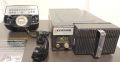
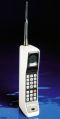 MotorolaDynaTac first commercially available handheld cellular phone 1983 ish Alan Pollard Collection.jpg Gcook
14:44, 8 March 2026
534 × 1,061; 82 KB
-
 Motorola Carphone Model TLD-1100, 1964, view 1 - National Electronics Museum - DSC00184.JPG Gcook
14:35, 8 March 2026
1,325 × 681; 137 KB
-

-
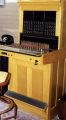 Manitoba Telecommunications Heritage Showcase-phone switchboard Alan Pollard collection.jpg Gcook
14:10, 8 March 2026
660 × 1,200; 198 KB
-

-

-
-
-
-
-
-

-
 2 - Charles surveying along HBR near KP 450, date unknown.jpg Kfanstone
22:03, 26 January 2026
258 × 302; 30 KB
-

-
 Templeton at Assiniboine River Bridges, St. James Bridge and Interchange Project. – Templeton Engineering Co. Brochure.jpeg Gcook
16:49, 13 January 2026
2,422 × 1,322; 1.24 MB
-

-
 Royal Commission on Flood Control Benefit 1958 – Templeton Engineering Co. Brochure .jpeg Gcook
16:33, 13 January 2026
2,032 × 2,904; 1.79 MB
-

-

-
 A worker inspecting Canol Pipeline – Legion, Canada’s Military History Magazine.jpg Gcook
16:28, 13 January 2026
134 × 139; 9 KB
-
 Carson Templeton – Templeton Engineering Co. Brochure.jpeg Gcook
16:27, 13 January 2026
1,904 × 2,404; 1.04 MB
-
-
-
-
 Dr. Doug Ruth student lounge. Photo credit – Engineers Geoscientist Education Foundation, website – January 10, 2025.jpg Gcook
11:40, 27 November 2025
452 × 358; 32 KB
-
-
 Doug Ruth Student Lounge plaque Dedication Ceremony.jpg Gcook
11:32, 27 November 2025
1,409 × 868; 196 KB
-
 Donald W. Craik Engineering Library, Price Faculty of Engineering.jpg Gcook
11:27, 27 November 2025
1,478 × 1,108; 356 KB
-
 Dr. Doug Ruth reveals Doug Ruth Laneway in 2018 in the EITC atrium. Photo credit – UM News – January 12, 2021.jpg Gcook
11:23, 27 November 2025
518 × 346; 50 KB
-
 Dr. Doug Ruth addresses alumni at the 2007 Engineering Homecoming. Photo credit - UM News – January 12, 2021.jpg Gcook
11:18, 27 November 2025
1,430 × 953; 350 KB
-
 Yyyy DAJ Ennis membership card registrar koropatnick.jpg Gcook
10:20, 31 October 2025
998 × 586; 152 KB
-
 1965 CR Bouskill membership card registrar algeo.jpg Gcook
10:19, 31 October 2025
1,107 × 680; 276 KB
-
 1964 CR Bouskill membership card registrar marantz.jpg Gcook
10:19, 31 October 2025
1,144 × 691; 367 KB
-
 1956 CR Bouskill membership card registrar landon.jpg Gcook
10:18, 31 October 2025
1,190 × 659; 311 KB
-


